{"name":"Current Note","query":"path:\"$filename$\"","chosenMapSource":0,"autoFit":true,"lock":true,"showLinks":true,"linkColor":"red","markerLabels":"off"} 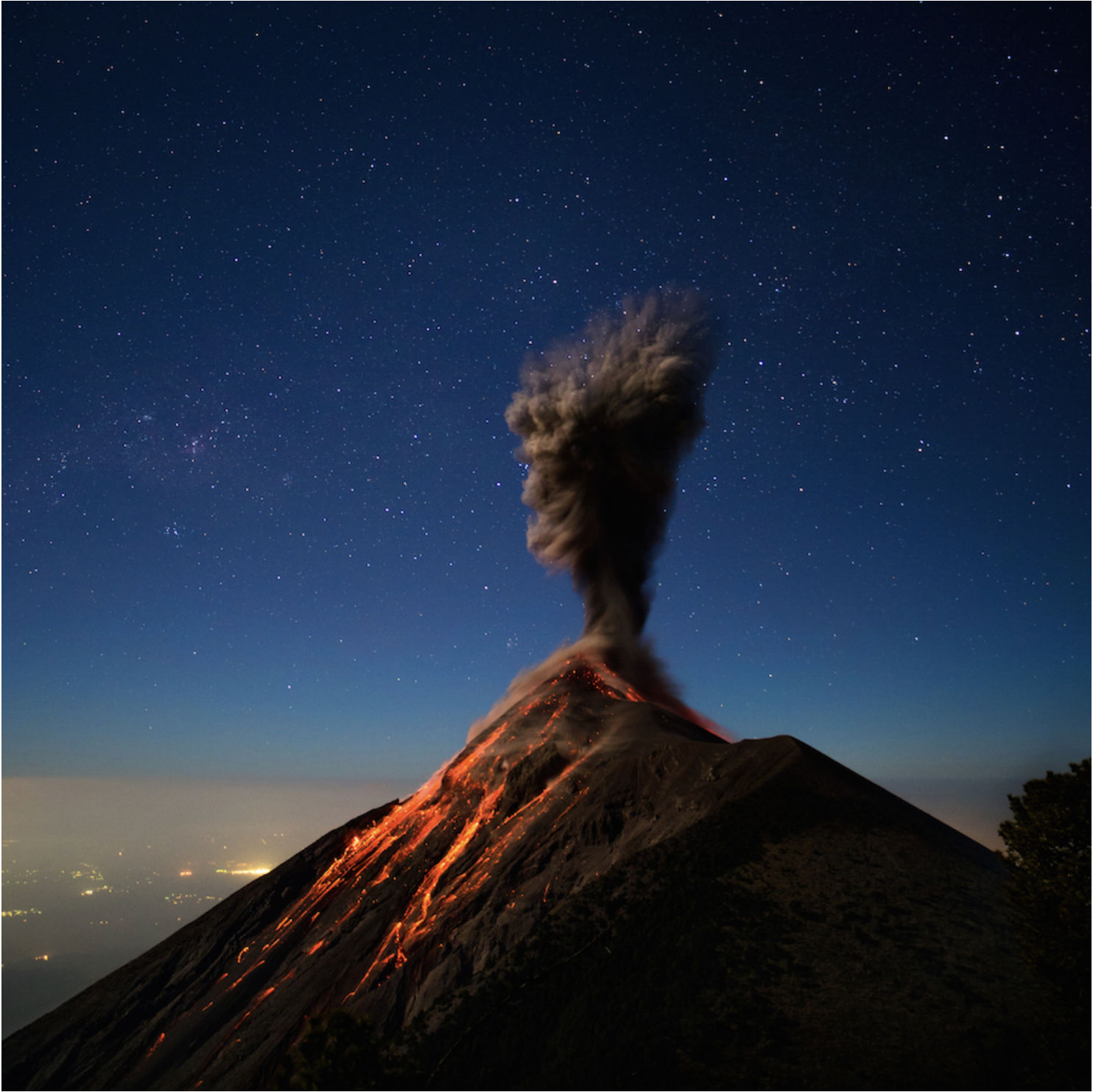
Description
Volcán de Fuego, located near Antigua, Guatemala, is renowned for its frequent volcanic activity. Photographer Andy Shepard captured stunning images of its eruptions from the summit of the adjacent Acatenango Volcano.
Photography Tips
Optimal Vantage Point: The summit of Acatenango Volcano, approximately 4,000 meters in elevation, offers a safe and excellent viewpoint to photograph Fuego’s eruptions. This location provides a clear line of sight to Fuego’s crater from a distance of just a few kilometers.
Timing and Patience: Eruptions can be unpredictable. Shepard’s experience involved waiting through the night, with eruptions occurring at intervals. Being prepared to capture sudden activity is crucial
Travel Information
Accessing the Area: Antigua, Guatemala, serves as the base for excursions to Acatenango and Fuego. Shepard reached Antigua after a 12-hour bus ride from Rio Dulce. From Antigua, local guides can facilitate the trek to Acatenango.
Hiking Details: The ascent to Acatenango’s summit typically takes about four hours, reaching elevations up to 3,600 meters. Trekkers often camp near the summit to observe Fuego’s nocturnal eruptions. Proper acclimatization and physical preparation are recommended due to the altitude and challenging terrain.
Guided Tours: Engaging a local guide is advisable for safety and navigation. Guides can assist with equipment, setting up camp, and providing insights into the volcanic activity.
Safety Considerations: Due to Fuego’s active status, it’s imperative to stay informed about current volcanic activity and adhere to local advisories. Observing eruptions from Acatenango is considered safer than approaching Fuego directly.